Route map. December currents dictated a counterclockwise course.
One of the things I like about kayaking the Gulf Islands is the opportunity to revisit campsites from my trip up the Inside Passage back in 2011. This time, I was looking forward to stopping once again at Pirate’s Cove Marine Park on De Courcy Island.
During my 2011 trip, I landed at Pirate’s Cove just as a young couple were pulling up in their double kayak. They invited me back to their house in Cedar to do laundry, take a shower, and sleep in a real bed. They gave me a recipe for cream cheese shrimp cocktail that I still use to this day.
There was no landing at Pirate’s Cove this time. At high tide, waves were washing over a tangle of driftwood logs at the top of the beach. Short of popping out of my kayak and wading ashore, there was no way I could have gotten past the logs. I skipped Pirate’s Cove and paddled on to Blackberry Point on Valdes Island.
Blackberry Point used to be a popular campground for kayakers, but the timber company that owns the land closed Blackberry Point to camping in 2017. I poked around on the beach but did not linger. It’s too bad—this was once the only campground anywhere on Valdes Island. Private property and Indian reserves have done for the rest of the landbase.
Wind and current were both in my favor, so I made excellent time to Cayetano Point at the south end of Valdes Island. Cayetano Point marks the western entrance to Porlier Pass, the waterbody separating Valdes and Galiano Islands. Currents through Porlier Pass run as high as ten knots, so it is essential to arrive at a favorable moment in the current cycle.
If anything, the wind and current had been a little too helpful. I arrived at Porlier Pass two and a half hours before the turn to flood. The ebb was still running at three knots in the wrong direction. I experimented with fighting the ebb and managed to crawl about halfway up the pass. Here, a rocky point protruded into the waterway, constricting the channel and causing the current to accelerate around the point.
It was only half a mile (800 m) further to the campground at Dionisio Point, but I could not force my way around the point. I retreated to a narrow bay with a gravel beach at its head where I could stretch my legs for an hour while the current moderated. When I returned, the currents were still strong enough to shove me around, but I managed to fight through to Dionisio Point.
Older kayaking guidebooks had led me to believe that all the campsites at Dionisio Point lay some distance inland from the landing beach. Not so—a sign at the beach declared that kayakers may camp in the grassy field immediately above the driftwood line.
Kayaking southward down Stuart Channel. Even with a fair northwest wind blowing, the weather remained cloudy and drizzly much of the day.
Cliffs of Valdes Island. Sandstone bluffs are some of the most distinctive features of the northern Gulf Islands, including Valdes and its neighbor, Gabriola.
Kayak on beach at Blackberry Point. Blackberry is not very a prominent point geographically, but its pale gravel beach can be recognized from miles away.
Kayaking into Porlier Pass, western entrance. In addition to reducing my forward progress, the ebb also pushed me laterally to the right, sending me clear across the mouth of the pass.
Virago Point, Porlier Pass rear range light, est. 1902. Today, such beacons are all but obsolete, even after electrification and automation.
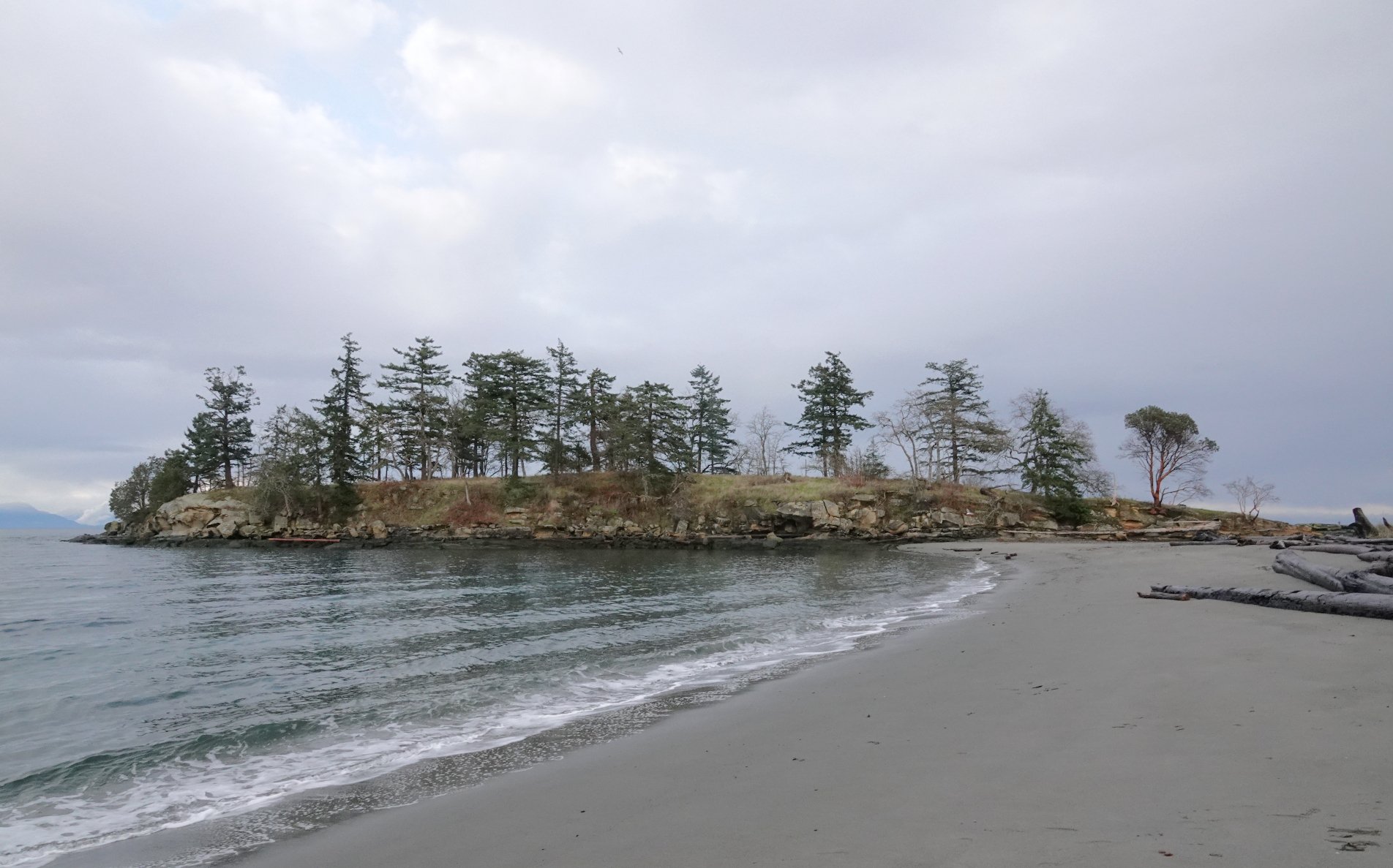
View of landing beach at Dionisio Point. Sandy beaches are few and far between in the Gulf Islands.
Winter kayaking often brings special challenges. Low-pressure cyclones are more common in winter than in any other season. Short winter days mean there sometimes isn’t enough daylight to wait for a favorable turn of the tide. Cold temperatures demand extra clothing and equipment. One of the rewards for all this hassle, however, is the abundance of seabirds and marine mammals.
Sea ducks were especially plentiful on this trip. I saw all three species of Bucephala, surf and white-winged scoters, common and red-breasted mergansers, and harlequin ducks. I also saw all four of the “Big Four” alcids: pigeon guillemots, common murres, rhinoceros auklets, and marbled murrelets, the latter of which were the most numerous of the alcids. I had hoped to see two of our more unusual wintertime visitors, the long-tailed duck and the ancient murrelet, but had no luck with either species on this trip.
The most remarkable birds were the Brandt’s cormorants. All three cormorant species were present in high numbers, but the Brandt’s cormorants were absolutely everywhere. Shortly after dawn, a flock of over a thousand Brandt’s flew past Dionisio Point, heading up the Strait of Georgia to forage. North of Oregon, I have never before seen so many of this species in one place. This one flock represented a substantial fraction of the entire wintertime population of Brandt’s cormorants in BC.
Sea lions were the most abundant marine mammals, far outnumbering the harbor seals. Steller sea lions were especially numerous. Three haulout sites on rocky points and islets around Porlier Pass and Gabriola Pass each hosted over two hundred Steller sea lions per site. Smaller colonies were hauled out in other locations around Valdes Island. A few dozen California sea lions were intermixed with the Stellers.
Common loon, Pilades Channel. I saw around forty common loons on this trip, plus a single red-throated loon.
Marbled murrelet, Porlier Pass. Like most alcids, marbled murrelets generally mate for life.
Horned grebes, Porlier Pass. This and the red-necked were the only two species of grebe I saw.
White-winged scoter, Detwiller Point. This species is usually encountered farther from shore than the more familiar surf scoter.
Buffleheads, Dionisio Point. The ducks had not yet begun to pair off for the breeding season.
California sea lion sleeping in water, Virago Point. Like many of the eared seals, sea lions often sleep on the water’s surface with their flippers elevated in the air, a behavior that is theorized to assist in regulating body temperature.
Steller sea lions and one California sea lion hauled out at front range light, the northwesternmost point in Porlier Pass. Also present are nine Brandt’s cormorants, one double-crested cormorant, and one pelagic cormorant.
The wind shifted to the southeast on the second day, once more giving me following winds during my transit up the outside of Valdes Island. I had originally planned to camp on Kendrick Island at the north end of Valdes, but the strengthening wind persuaded me to look elsewhere. Kendrick Island is a lovely campsite, but it’s not ideal during strong winds. The landing is terrible on a bare sandstone shelf, and campsite enjoys no protection from southerly or southeasterly winds.
Instead of Kendrick, I landed a few miles north on Saturnina Island, one of the Flat Top Islands. Here I found a much easier landing beach and a little more protection from the wind.
Saturnina Island is privately owned by the BC Parks Foundation. The island is managed as a nature reserve under a ninety-nine-year lease to the Islands Trust Conservancy. The Islands Trust Conservancy is a corporation of the Islands Trust, a form of municipal government unique to the Strait of Georgia. Although the Islands Trust Conservancy has not yet published its management plan for Saturnina, there is no chance the trustees will allow camping on the island. Land is scarce in the Gulf Islands, and the locals aren’t often eager to make room for campers.
Fortunately for us non-locals, the privatization of Saturnina does not extend to a tiny rock offshore of the island, connected to the main island by a tombolo at low tide. The islet remains crown land, where the BC Parks Foundation and its allies on the Islands Trust Council have no power to exclude the public. A small thicket of Douglas-fir sheltered me from the wind.
From Saturnina Island, it was a short hop back to the boat ramp on the final morning of the trip. I hit the tidal rapids at Gabriola Pass minutes after the turn to ebb. Just for fun, I took advantage of the building current to sprint my kayak at speeds up to seven knots.
The shortest route between Gabriola Pass and the boat ramp runs through the “hole in the wall” between Link and De Courcy Islands. The topographic map on my GPS made it look easy to slip through the hole, but the satellite imagery on my phone made it look questionable. I arrived at a 3.8-meter (12.5 ft.) high tide and drifted over the rocks with no complications.
Mount Baker at dawn, seen from Dionisio Point. Baker is by far the most prominent volcano along the Strait of Georgia.
Sword ferns, Dionisio Point. I got so turned around in the maze of unmarked forest trails I ended up wandering out of the park altogether.
Canoe Islet with hundreds of Steller sea lions. A ten-knot breeze generated enough noise to drown out the sea lions’ roars until I was downwind of their haulout sites.
Approaching Flat Top Islands from south. These islands provide a welcome refuge after the exposed waters of the strait.
Islet off Saturnina Island. The gravel tombolo visible to the left connects this small, public islet to the larger, private Saturnina Island.
Kayaking hole in the wall between De Courcy Island to the left and Link Island to the right. Shooting this narrow passage saves several miles of paddling when crossing between Valdes Island and Vancouver Island.
Morning view southward down Stuart Channel. From left to right: Pylades, Valdes, Galiano, Reid, Salt Spring, Thetis, and Vancouver Islands.
Every visit to the Gulf Islands leaves me with happy memories. This one did, too. Transiting the passes and timing the tides provided just enough of a navigational challenge to be interesting but not so much as to seem threatening. Both my campsites afforded sweeping views and beautiful beaches. Best of all, the marine mammals and seabirds I encountered outnumbered the people I encountered by a thousand to one.
—Alex Sidles